

Skydio Extend Catalog
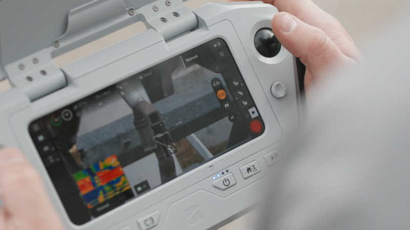
Your drone data made actionable.
Take advantage of the drone industry's largest catalog of workflow and integration partnerships to initiate flights and make your captured data actionable from the moment it's collected.
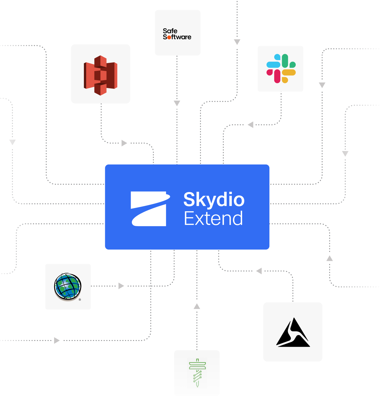
There are 32 integrations, filtered to 32.

AirData UAV
Integrated fleet management

AirWise Solutions
Integrated fleet management and real-time situational awareness

AlarisPro
Integrated fleet management

Aloft
Integrated fleet management and real-time telemetry integration

ANRA Technologies
Integrated fleet management and common operational picture

Armada
Enable edge compute and situational awareness
Axon Air
Integrtated DFR program management
Axon Evidence
Integrate all your digital evidence in a single, secure place
Axon Fusus
Bi-directional integration of data into a real-time crime center (RTCC) and Skydio
Axon Respond
Integrate location data from your Axon devices to Skydio

Buzz Solutions
AI-assisted inspection and defect detection
CentralSquare
Integrate calls for service (CFS) into Skydio
DedroneBeyond
Integrated radar technology to serve as a virtual visual observer

DroneDeploy
Automated media transfer, photogrammetry, and analytics

DroneLogbook
Integrated fleet management

DroneSense
Integrate for fleet management, video streaming, and telemetry
Faro
Media transfer and photogrammetry
Genetec
Stream drone footage into the Genetec Security Center

gNext Labs
Sync Skydio data to gNext for automatic model processing and digital twin inspection tools for 40+ pre-defined asset types and use cases

Indoor Robotics
Indoor-focused security operations

Levatas
AI inspection models for thermal anomalies, gauge reading, and more.

MEPPI
Export media for utility-focused defect detection and gauge reading
Milestone
Stream drone footage into XProtect video management software
Motorola Solutions
Integrate calls for service (CFS) into Skydio

Optelos
Media transfer, photogrammetry, and analytics
Peraton Public Safety Solutions
Integrate calls for service and CAD data into Skydio

PIX4D
Media transfer and photogrammetry

RaptorMaps
Solar farm inspection and defect detection

Site Scan for ArcGIS by Esri
Automated media transfer and photogrammetry

STRAX Intelligence Group
Integrate drone footage into the STRAX Response intelligence platform
Tyler Technologies
Integrate calls for service (CFS) into Skydio
Versaterm
Integrate calls for service (CFS) into Skydio
Discover how Skydio Extend can be customized for your workflow.
Contact Sales